Huayna Picchu, Peru
The mountain peak behind Machu Picchu.


Return to
MACHU PICCHU / INCA TRAIL
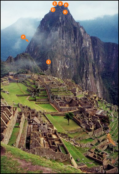
Huayna Picchu map. Trail Floating stairs. Floating stairs Looking back. Moon temple

1. Trail
2. Tunnel
3. Floating stairs
4. House of Three WIndows
5. Looking back
6. Arrow stone
7. Temple of the Moon

YouTube

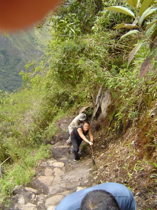
Huayna Picchu trail.

1. TRAIL
The trail is quite steep. It is a journey, a pilgmrage to the top, to the heavens, to the apu of Huayna Picchu.

TOP

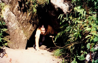
Huayna Picchu tunnel.

2. TUNNEL
The path even leads through a tunnel.

TOP

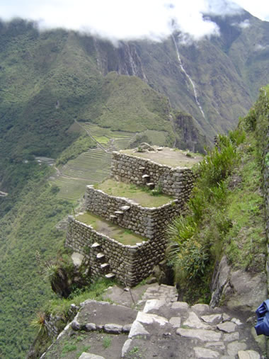
Huayna Picchu floating stairs.

3. FLOATING STAIRS
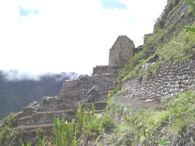
Floating stairs are stairs built directly into the terrace wall.

TOP

Builiding

Huayna Picchu - 3 Window Building

4. HOUSE OF THREE WINDOWS
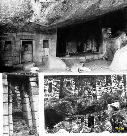
There are a few structures and terraces.

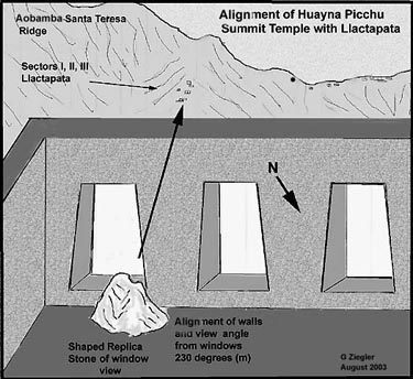
Temple looks W to Llactapata. Adams. Inside is an Image Stone of the Llactapata ridge.

TOP

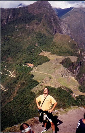
Looking back.

5. LOOKING BACK
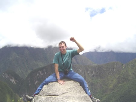
The mountain is solid rock on top, so you can get an incredible look back at Machu Piccchu.

Mountains were seen as male and here at the top is solid stone, an arrow carving. Fertilizing rain pours from the summit. Caves and Temple of the Moon were female, lower, intimate, womb-like, and close to Urubamba R. These were opposites, but not separate - parts of the whole. Grieder/Christie

TOP

Arrow stone.

6. ARROW STONE
V shaped Seat points south to Mt Salcantay and Intihuantana at MP, "directly at a wedge-shaped hollow carved into the base, which in turn points at Salcantay." Adams

There are other arrow stones at Intihuatana and Sacred Plaza. Christie

TOP

Moon Temple

7. TEMPLE OF THE MOON
The temple and caves would have been seen as a way to commune directly with the apu of Huayna Picchu. Christie

Mountains were seen as male and here at the top is solid stone, an arrow carving. Fertilizing rain pours from the summit. Caves and Temple of the Moon were female, lower, intimate, womb-like, and close to Urubamba R. These were opposites, but not separate - parts of the whole. Grieder/Christie

More information.

TOP


Return to
MAIN MAP

Turn layers -->
On or Off to simplify view

MORE INFO:
Bibliography

Glossary

Inca Rulers

Names

Religion

Tribes


For the best view,
choose Satelitte -->


MACHU PICCHU
Huayna Picchu, MP overlook
Llactapata, MP alignments
Machu Picchu, original lost city

INCA TRAIL
Inty Pata, along Inca Trail, very long stairs
Phuyu Pata Marka, along Inca Trail, odd building
Sayac Marka, fort along Inca Trail
Winay Wayna, along Inca Trail, 16 fountains

SITES ALONG URUBAMBA R
Chachabamba
, huaca along Urubamba
Choquesuysuy, large site along Urubamba
River Intihuatana, MP alignments

MACHU PICCHU / INCA TRAIL

VILCABAMBA REGION, Machu Picchu was the entrance to this lost junge area.

MAIN MAP

ANDY ROSCOE'S
Free Tour Guides

Digital: PDF. Use Google Drive.
Printing: PDF. Download, Print two sided, no scaling.

Machu Picchu: digital | print | website

Inca Trail: digital | print | website

Ollantaytambo: digital | print | website

TIPS
Switch the map type to Terrain and zoom in to view elevation heights.

MINI BIBLIOGRAPHY
Main Map : Pages with more details and geographic locations.

Thomson: Locations based on material from Hugh Thomson, Mark Rose, John Hemming, Pedro Sancho, John Hyslop, Paul Fejos.

Bingham: Locations based on the books and writings of Hiram Bingham, Paul Steele, George Squier, Kim MacQuarrie, Richard Burger.

Prescott: Locations based on material from William Prescott, Victor von Hagen, Adriana von Hagen, Walter Alva.

National Geo: Locations based on the books and magazines of National Geographic, Edward Hyams, Vincent Lee, and Gene Savoy.

Detailed Bibliography.

LEGEND
Colors match map version.

LinkLocation with link to map with more info.


PhotoNote with photo.


noteNote without photo.


CONTACT
If you have some details, or photos, or find a mistake, or have a question - let me know at
andy@ andyroscoe.com


MY OTHER WEBSITES: Roscoville . Andy Roscoe . Rubber Spider Creative . Bottle Caps . Brewery . Monica Rose